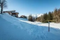
Family walk in the forest.
Description
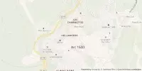
From Place du Soleil, head for the bus station, cross it to join the main road.
Follow signs for "Village de Courbaton".
Your walk begins on the road leading to the village, then as you round the bend, take the path that takes you into the clearing and then into the forest.
Easy walk, gentle slope and easy terrain. For the whole family.
Welcome information
Walking shoes are recommended, as well as a water bottle and windbreaker.
Opening period
Subject to favorable snow and weather conditions.
Services
- Services
- Pets welcome
Capacity and customer types
- Target audiences
- Level green – easy
- Pets allowed
- Yes
Environment
- Forest location
- Mountain location
Directions
- Distance : 3.4km
- Durée journalière : 60min
- Dénivelé + : 65m
- Dénivelé - : 135m
- Altitude moyenne : 1549m
- Altitude max : 1620m
Practical information
Contact and information
Location