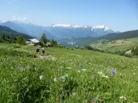
Discover the whole valley at your own pace via the Grand Tour de Tarentaise, from two days to several weeks, according to your own plans and the different sectors: Beaufortain/Mont Blanc, Haute Tarentaise, Around La Plagne, Vanoise, Three Valleys, Lauzière.
Description
Sectors :
- Beaufortain / Mont-Blanc: 4 to 5 days, approximately 4,400 meters of ascending elevation.
- Haute Tarentaise: 4 to 6 days, approximately 3,400m of ascending elevation.
- Around La Plagne: 4 days, about 3,400m of ascending elevation.
- Vanoise: 4 to 6 days, approximately 3,600m of ascending elevation.
- Three Valleys: 4 to 5 days, approximately 2,400m of ascending elevation.
- Lauzière: 3 to 4 days, approximately 1,600m of ascending elevation.
Welcome information
Adapted to people who already had their first mountain hiking experience.
Opening period
From 15/06 to 01/10.
Services
- Services
- Pets welcome
- Accommodation
Situation
The whole Tarentaise Valley
Capacity and customer types
- Target audiences
- Level red – hard
- For experts / practiced
- Walkers/hikers
- Age range
- Entre 12 ans et 99 ans
- Pets allowed
- Yes
Environment
- Mountain location
Directions
- Distance : 240km
- Dénivelé + : 18800m
- Dénivelé - : 0m
- Altitude max : 2786m
Practical information
Contact and information
Location